
The town of Haskovo is the centre of the district with a population of 80 000 inhabitants lying at a distance of 222 km southeast of Sofia. Haskovo is a municipal centre with 36 component settlements. It is situated along the Haskovska River not far away from the Greek and Turkish borders. A road connecting Europe and Asia crosses Haskovo. The symbol of the town is the monument of the Holy Virgin opened in 2003.
The settlement is the successor of a middle age fortress with the mane of Marsa. During the first half of XIII c. here was waged one of the most successful battles of King Ivan Asen II (1218-1241) which hit the Byzantine governor Teodor Komnin by defeating his troops near the village of Klokotnitza. During the Ottoman yoke Haskovo was an agrarian and craftsman's town. It was mentioned in the Ottoman documents under the name of Has Kyoi. The town was liberated by General Gurko's troops in 1878. After the Liberation the settlements developed fast and became one of the centres of the tobacco manufacturing industry. Haskovo is the home town of the great Bulgarian professor Asen Zlatarov.
The tourist sights of the town are: the old town with the churches "St. Archangel Michael and Gavril" (1861), "Sveta Bogoroditza"/Holy Virgin/ (1837), Eski Mosque (1835); the Revival period houses - The Shishmanov's house and the Paskalev's house.
The region is rich in historic sites. There are dolmens, Thracian niches and sacred places, over 100 Thracian mounds, the medieval fortress "Bukelon", where the Latin emperor Balduin Flanderski was captured.
The cultural-historic sights on the territory of the district are: the Thracian dome tomb at the village of Mezek, the Thracian and Middle Age fortresses near the village of Mezek, remains of medieval fortress near the village of Lyutitza, the Ustrem Monastery, The Thracian tomb at Aleksandrovo.
Among the most famous protected sites and natural landmarks are: "Boraka" "Dolnata Ova", "Oludere", "Lozenski Kat", the rocky phenomena "Kovan Kaya", "Gluhite Kamani" /The deaf stones/, "Kush Kaya" "Kaleto", "Dervishka mogila", "Brasnarski stol"/ Barber's chair/, "Pobit kamak" and "Orlova Skala" /Eagle's Rock/. Important ornithological sites on the territory of the district are Yuzhen Sakar, Madzharovo and Byala Reka.
The Haskovo District has traditions in the manufacture of wine and alcoholic beverages. The top quality wineries in the region are: Haskovo, Stambolovo, Lyubimetz and Ivailovgrad.
Tourist sighs
The monument of Holy Virgin in Haskovo was opened in 2003. It is situated on the top of the Mladezhki Hill. It is 32,80 m high with a 15 m-long statue weighing 80 tons.
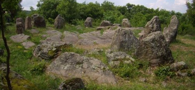
The rocky ensemble "Angel Voivoda" in the village of Angel Voivoda is one of the most numerous groups of trapeze and semi-circle shaped niches hewn in the rocks with a combination of staircases, rooms, pools and canals.
The Rocky niches in Haskovo District are one of the strangest and inexplicable phenomena of the megalithic culture of the Eastern Rhodope region. The niches are hewn very high on well-shaped rocks or mountainous massifs in hard-to-reach places most often on the sun-lit side of the slopes. Predominantly there are trapeze-shaped niches with a height of 0,60-1,00 m and depth of 0,45 m. There are also bigger niches of up to 2 m height and depth of 1,50 m.
The Thracian tomb of Aleksandrovo lies at a distance of 17 km from the district centre. The tomb was discovered in 2000 and dates back to the IV c. The mural paintings in the tomb are well preserved and are a new important source for the physical characteristics of the Thracian people, their clothing and weapons.
The rocky basins /sharapani/ in the Haskovo region are of round or square shape connected to canals and overflow drains. The word sharapani in Turkish means grapes-squeezing presses used for the manufacture of wine. They are the most widely spread megalithic monuments and one can see them in hundreds of high places in the region following the other rocky formations. Some historians believe the sharpani are altars on which the Thracian kings performed sacrifices and the sacrificial blood ran along the gullies. The latest research shows that they were used for the manufacture of ritual wine connected to the cult towards the Thracian god Dionysius.

Ancient Roman villa "Armira" - mosaic, the town of Ivaylovgrad
The town of Ivailovgrad has a population of 4 000 inhabitants and is a municipal centre with 50 component settlements. The town lies at a distance of 120 km southeast of Haskovo. Until 1934 the town was known under the name of Ortakyoi.
The present-day town is the successor of the middle age town-fortress Lyutitza. In the Ottoman registry books from 1676 the town is written under the name of Byuyuk Ortakyoi. There are 50 monuments of culture in the town of which 6 are architectural, 18 archaeological and 26 are churches.
The tourist sighs of the town are: the church "Preobrazhenie Gospodne" (1805), traditional Rodopean houses, the History Museum, the Ethnographic Museum, remains from the medieval fortress Lyutitza and the Roman villa "Armira".
The medieval fortress Lyutitza in the town of Ivailovgrad is situated southwest of the town. The fortified walls are well preserved and at some places reach a height of 10 m. They surround an area of 14 000 m2. The Lyutitza fortress had 12 towers of which 9 are preserved in its almost original way.
The Roman villa "Armira" in Ivailovgrad was discovered in 1964 during excavations. It dates from II - IV c. and has a precious decoration on the walls and the floors. The marble walls and the multi-coloured floor mosaics depict scenes from the mythology, vegetation images and geometrical figures. The villa has occupied an area of 2 200 m2.
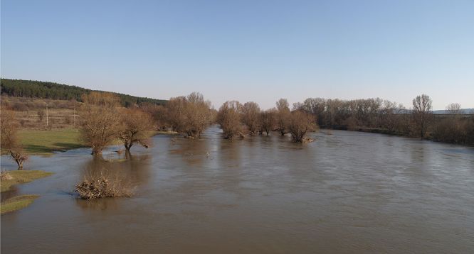
The town of Harmanli, Maritsa River
The town of Harmanli is the centre of a municipality which occupies the central part of the Haskovo District. The municipality has 24 settlements. The town of Harmanli has a population of 20 000 inhabitants. The altitude of the town varies between 80 -300 m. The town is situated along the Harmanliyska River which is the right tributary of the Maritza River.
In the region were discovered settlement mounds from the Eneolith, Thracian and Roman mounds and a medieval settlement. The present-day administrative centre originated in 1510 by the road connecting Asia and Europe. Since then is the first written evidence about its existence. In 1585 the Turkish vizier Sivyush Pasha ordered to be built a vault bridge over the river. The humpback bridge is preserved almost intact till present times.
The tourist sights of the town are: The Humpback Bridge, the Kervansarayat, built in the middle of XV c., the churches "St. Atanasii" from 1835 and "St. Ivan Rilski" and the menhir at the village of Ovcharovo.
The Menhir at the village of Ovcharovo dates back to the first century B.C. It is a vertically stuck into the ground huge rough stone block having a cult purpose. There are menhirs in Western Europe, North Africa, India, Siberia and Caucasus.
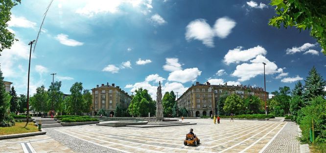
The town of Dimitrovgrad
The town of Dimitrovgrad has a population of 43 000 inhabitants and is the administrative municipal centre of 26 component settlements. It lies along the Maritza River at a distance of 16 km north of Haskovo. The town originated in 1947 after the merging of the villages of Rakovski, Mariino and Chernokonyovo.
The tourist sights of the town are: the History Museum, the Art Gallery, the church "St. Dimiter" (1880-1884), the sanctuary of the nymphs and Aphrodite at the village of Kasnakovo.
17 m northwest of Dimitrovgrad is situated the town of Merichleri. It is a national spa centre. The mineral waters have a capacity of 5 litres per second and a temperature of 31-42oC. The archaeological findings at Merichleri date back to the Eneolith, Thracian, Roman and Middle Ages. The town is mentioned in the Ottoman registry books under the name of Merichlu in 1605.
The Thracian sanctuary of the nymphs and Aphrodite at the village of Kasnakovo includes cult buildings dating back to II c., an inn from the III c., an amphitheatre from IV c. and three architecturally formed pool-springs. The sanctuary lies at a distance of 1,5 km from the village of Kasnakovo.

The town of Svilengrad - the bridge was built in 1529
The town of Svilengrad has a population of 19 000 inhabitants and is located at the Turkish-Greek border. Svilengrad is a municipal centre with 23 component settlements. It lies at a distance of 67 km southeast of Haskovo along both banks of the Maritza River. The old name of the town is Mustafa Pasha which was used until 1934.
The favourable natural resources and the geographical location of the region have contributed to the development of the region and its population since ancient times. There are remains of ancient Thracian settlements, sanctuaries and tomb mounds. The region was an arena of military confrontations between Byzantine and Bulgarian troops. The present-day town developed in XV c. close to the remains of the Thracian-Roman settlement of Burdenis. Today only a few ruins of this settlement have been preserved. During the Ottoman yoke the town was known under the name Mustafa Pasha. The symbol of the town is a stone bridge built in 1529 during the reign of Mustafa Pasha.
The tourist sights of the town are: the stone bridge, the Thracian tomb "Mezek", remains of a medieval fortress near Mezek, rocky churches near the villages of Mihalich and Matochina.
The Thracian tomb "Mezek" at the village of Mezek was discovered in 1931. It is situated in the Maltepe hill. The Thracian tomb dates back to IV c. B.C. and is preserved in its original way. The tomb has a 20,65 m long corridor two different-size rectangular rooms and a round chamber. The round chamber has a hive-shaped roof starting from its base. At the bottom of the chamber there is a stone bed. Unique objects of gold, bronze, iron, glass and ceramics were found in the tomb. They are of high artistic value. Through the village of Mezek passed the road connecting Kabile /Yambol town/ with Adrianopol/ Edirne town in Turkey/.
The medieval fortress at the village of Mezek dates back to XI-XII c. The fortress is comparatively well preserved. The medieval fortress of Neuzetikon has had a significant defense meaning.
The rocky churches on the territories of the villages of Mihalich and Matochina lie at a distance of 40 km east of the town. The churches date back to X c. and are among the most well-preserved churches in Bulgaria.
The Stone Bridge in Svilengrad was built in 1529. It is 300 m long, 6 m wide and has 20 vault openings. The bridge is proclaimed for a monument of culture.

The Ustrem Monastery
The town of Topolovgrad is the centre of a municipality lying at a distance of 84 km northeast of Haskovo. The municipality has 20 component settlements. Topolovgrad has a population of about 7 000 inhabitants and is located at the northeastern slopes of Sakar Mountain. The settlement was known under the name of Kavaklii until 1934. The region is specialized in the production of grains, cotton, technical cultures and tobacco.
In the region of Toplovgrad there are remains of ancient fortresses. The settlement was mentioned in the Ottoman documents from 1564.
The tourist sights of the town are: the remains of the ancient settlement of Paleocastro, the dolmens at the village of Hlyabovo and the Ustrem monastery.
Paleocastro at the village of Hlyabovo is a rocky Thracian sanctuary. According to specialists the 150 rocky circles are related to the Thracian cult towards the sun. There are also dolmens in the region of Hlyabovo.
The Ustrem Monastery "Sveta Troitza" /Holy Trinity/ was built in XIV c. The monastery complex consists of housing and farm buildings and a church. The church was built in 1836 and has precious icons and mural paintings.
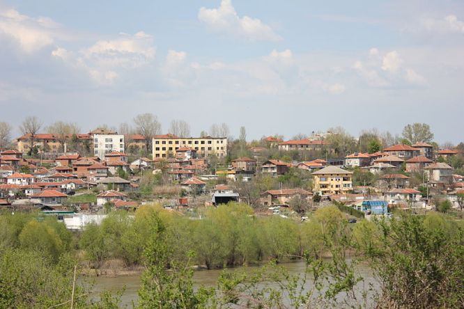
View of Simeonovgrad and river Maritsa
The town of Simeonovgrad is the centre of a municipality lying at a distance of 29 km northeast of Haskovo. The municipality has 8 component settlements. Simeonovgrad has a population of about 8 000 inhabitants and is situated along the Maritza River. The settlement was known under the name of Seimen until 1929. The region is specialized in the production of grains, cotton, technical cultures and tobacco.
In the region of Simeonovgrad there are archaeological findings from the Neolith, Eneolith and the medieval fortress Konstantzia. The settlement entered the limits of Bulgaria in 1201.
The town of Lyubimetz is the centre of a municipality lying at a distance of 52 km southeast of Haskovo. The municipality has 9 component settlements. Lyubimetz has a population of 8 000 inhabitants and is situated along the Maritza River. The settlement was known under the name of Hebibchevo until 1906. The region is specialized in the manufacture of wine, tobacco, fruit and vegetable growing.
In the region of Lyubimetz there are remains of a Roman station on the ancient road connecting Europe with Asia, a medieval settlement and a necropolis. The town of Lyubimetz is mentioned in the Ottoman documents from XVII c.
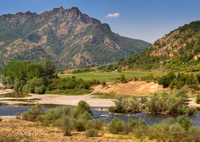
Arda River around the town of Madzharovo
The town of Madzharovo is the centre of a municipality lying at a distance of 60 km southeast of Haskovo. The municipality has 18 component settlements. Madzharovo has a population of about 1 000 inhabitants and is located at the Eastern Rhdope Mountains. The settlement was known under the name of Yatadzhik until 1934.
Near Madzharovo were discovered a Thracian fortress, sanctuaries and a necropolis.
The village of Stambolovo is the centre of a municipality in the Haskovo District with 25 component settlements. The village has a population of 500 inhabitants and is located at the Eastern Rhodope Mountains. The region is specialized in the production of wine, grains and stock-breeding.
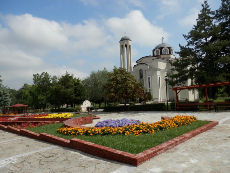
The village of Mineralni bani
The village of Mineralni Bani is the centre of a municipality in the Haskovo District with 11 component settlements. The village has a population of 1 500 inhabitants and is located at the Eastern Rhodope Mountains. The village was known under the name of Haskovski Mineralni Bani until 1955. The name of the settlement comes from the mineral springs in the region. They have a capacity of 36 litres per second and a temperature of 50-58oC. The village of Mineralni Bani is a natural spa centre. The mineral waters are suitable for treating traumas of the vertebral column, diseases of the locomotory system, neurological, gynaecological and other diseases.
On the territory of the village there are findings from a Neolithic settlement, Thracian dolmens, wineries, Roman thermal baths, ancient and medieval fortresses and a medieval town.
The tourist sights of the village are the sharpani - unique Thracian wineries from I century B.C.


